In 2018, The Trail Conservancy (then The Trail Foundation) established criteria by which its projects were selected. These criteria centered around two focus areas: 1) Community needs and benefits and 2) TTC’s capacity and ability to complete the projects. With this criterion in mind, TTC selected 15 charter projects to honor its 15th anniversary and created the Corgan Canopy Fund – a fund dedicated to financing the initial phases of each project.
The projects were all slated for completion when TTC celebrated its 20th Anniversary in 2023. The projects ranged from new trailheads and bathrooms to new water access points and playgrounds. Nine projects were on the east side of the Trail, four on the west, and two along the entirety of the Trail. The map below identifies the 15 projects and provides detailed descriptions (click to enlarge).
![]()
Comprehensive Signage Plan
Excellent signage is a critical component of a successful urban trail. TTC had already completed a Master Signage Package installed west of I-35, including wayfinding and spoke trails signs. This signage promotes a favorable image of Austin characterized by originality, quality, beauty, and civic pride. Not only does a signage package need to be installed on the Trail’s east side, but an inventory of all remaining Trail signs needs to be completed so that all signage is comprehensively coordinated and functional.
Ecological Restoration
Using the Ecological Restoration Guidelines as a reference for this ongoing work, this program continues to grow in sophistication and impact on the health of the Trail and surrounding parkland ecosystems. This program encourages the strategic use of resources from all city departments, including the Parks and Recreation Department and Forestry and Watershed Protection, to have the greatest impact on the ecological and aesthetic value of an exceptional natural resource: our Trail.
Zilker Trailhead
With the growing use of the Trail, an increasing number of Trail users are entering between the end of the Zilker berms and the Trail’s native areas. By creating a trailhead that addresses this increased use while protecting sensitive natural areas, we can accommodate the needs of nature and users alike.
Lamar Boardwalk Study (Northshore)
One of the few remaining pinch points, the Trail at Lamar and Cesar Chavez pose a safety hazard due to its proximity to the busy street. A feasibility study on an overwater boardwalk structure could provide a road map to a safer Trail in this area.
Drake Bridge Commons (North First St. Trail Under Bridge)
This project intends to improve the zone under the north side of the First Street Bridge, giving particular consideration to the water’s edge, the Trail surface, and the concrete abutment of the bridge itself. It may also consider seating, lighting, and artwork. While the focus is the area under the bridge, an extended zone on each side will also be considered.
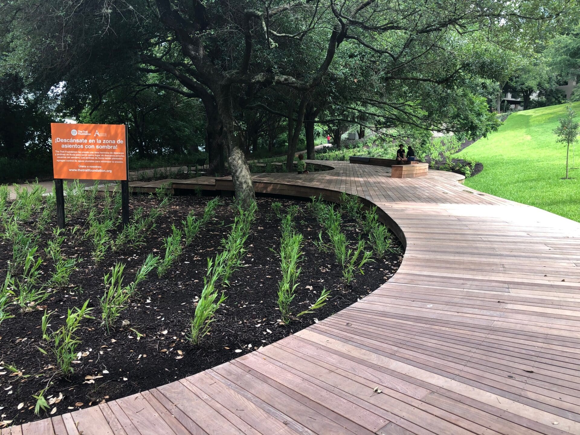
Brazos Bluff
The parkland adjacent to the Four Seasons is steeply sloped, causing significant erosion of the Trail and the riparian edge when it rains. This project addressed the stormwater that flows across this site in an aesthetically pleasing and ecologically sensitive manner that prevents further erosion of the Trail and the lake edge. This includes a deck along the trail for users to gather or rest and to protect the sensitive roots of the existing shade trees.
Play Area – East Side
As Austin continues to grow, more and more families are looking for places to gather, rest, and play along the Trail. The Trail Conservancy would like to provide creative spaces for play that will engage entire families and reflect the immersive feeling of nature the Trail evokes. This project is in consideration under our Holly Area improvements set to begin community engagement in 2024.
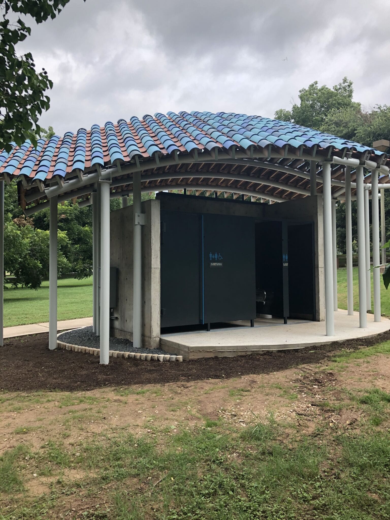
Festival Beach Restroom Replacement
The restroom at Festival Beach, east of I-35, was identified for replacement in the Holly Shores Master Plan. Under the direction of an architect sensitive to the depth of history and cultural identity of this special park space, the restroom was updated in June 2020.
Holly Trail Enhancement
As part of the Holly Shores Master Plan, the Austin Parks and Recreation Department realigned the Trail to the lake edge near the decommissioned Holly Power Plant. The Trail is now connected, keeping users closer to the lake and out of the neighborhood streets, creating a more peaceful and safe experience. The realignment also provided the opportunity to add shade and cooling through creative design solutions and trees. Something this neighborhood was lacking.
Holly Shores Trailhead – Connection to EastLink Trail
Connectivity for pedestrians and cyclists is a growing priority for the City of Austin, and providing a safe connection to EastLink at the new Trail realignment at Holly Shores brings together two important trails that will connect all Austinites.
Holly Point
The Trail was realigned at the decommissioned Holly Power Plant site and completed in 2022. Now that the Trail is complete, there is an increased desire to view and access the water for fishing. By providing more formalized access in an already well-used area, we can protect the riparian habitat while still allowing people to engage in the activities they love. This project will begin construction in 2024.
Pleasant Valley/Lakeshore Blvd Restroom
As the east side of the Trail continues to see increased usage, the Pleasant Valley and Lakeshore Boulevard intersection will function more as a Trailhead and entry point. With Country Club Creek Trail across the street and the nearest restrooms over a half mile away, there is a great need for a restroom facility.
Pleasant Valley/Lakeshore Trailhead and Water Access
With the completion of the Oracle Campus across Lakeshore Boulevard and the proposed upgrades to the Country Club Creek Trail across Pleasant Valley, the parkland and Trail at Pleasant Valley and Lakeshore Boulevard will become more heavily used. As shown in the TTC-created Southeast Shores Masterplan, a trailhead will create a gathering space for people to meet and a water access point to interact with the water and nature while protecting sensitive shoreline habitat.
Bridge Study: Holly/Lakeshore Peninsula
While the Trail’s west side has regular north/south opportunities to cross the lake, the 4 miles of Trail on the east side do not. TTC would like to conduct a feasibility study on the north/ south connection from the new Trail alignment at Holly Shores to the peninsula off Lakeshore Blvd.
Lakeshore Park: Deck and Overlook
On the Boardwalk’s east side, off Lakeshore Boulevard, are two opportunities to provide inviting gathering spaces by creating an over water platform at an existing outfall structure and a deck underneath the towering Live Oaks overlooking a playful, grassy field.