Status: Installation | October 2025 - Spring 2026
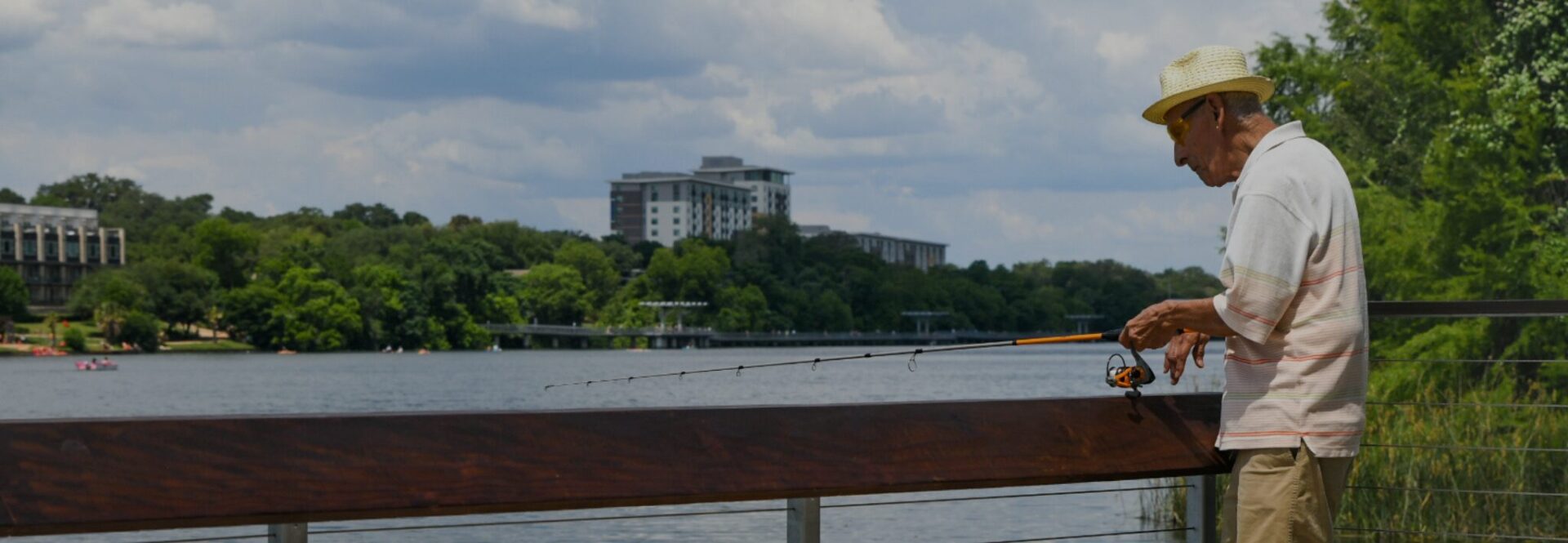
The Ann and Roy Butler Hike-and-Bike Trail is a vital 10-mile loop connecting Austin’s north, south, east, and west, serving as a hub for recreation, education, and transportation. However, outdated and inconsistent signage created navigational challenges. The Trail Conservancy’s Comprehensive Signage Plan project reviewed and updated the previous wayfinding system to improve, expand, increase visibility, and enhance brand expression along the Butler Trail. New signage improves connections between areas along the Trail, including trailheads, parks, and other community areas.
Share Your Feedback: Signage Survey
You’ve seen the new mile markers, directional signage, and trailhead signs; now’s your chance to tell us what you think! Share your experience with the new trail signage and be entered to win a 1L YETI waterproof gear case or a $50 HEB gift card.
about the project
In 2022, The Trail Conservancy (TTC) partnered with Stantec (formerly Page/Signage & Wayfinding) to design a modern, inclusive wayfinding system. Guided by community input and TTC’s 2021 Safety & Mobility Study, the Comprehensive Signage Plan was completed in 2025 to improve visibility, connectivity, and safety across the Trail. New signage will enhance the Trail’s natural beauty, promote TTC’s stewardship, and feature bilingual, easy-to-read designs that serve Austin’s diverse communities.
New signs will be installed in phases starting in October 2025 and will continue through spring 2026.
Sign Fabrication/Installation Cost: $327,725
Project Team: Stantec (formerly Page Signage and Wayfinding), Cultural Strategies, GraphTec
project timeline
Inventory & Analysis - One virtual survey, in-person on-Trail pop-ups, and focus group sessions will be conducted to solicit input on public desires for the Trail signage.
Concept through Schematic Design - One virtual survey, on-Trail interviews, in-person on-Trail pop-ups, and community meetings to present the design solutions to the public.
Comprehensive Plan Development - One virtual survey, on-Trail pilot signage, and in-person on-Trail pop-ups to present the draft comprehensive plan and to receive final community input.
TTC finalized the Comprehensive Signage Plan, a document meant to design a clear and concise signage system for the Butler Trail that will support wayfinding and elevate the trail user experience without cluttering the Trail's natural beauty. This plan is intended to provide direction and guidelines for implementing the new signage system for TTC staff, consultants, fabricators, and supporters.
100 signs were removed from the Butler Trail
- mile markers
- restroom identification signs
- directional signage at the Barton Creek bridge and the Boardwalk at Riverside
- speed limit signs in the section by the Hyatt and at the Holly Shores Lakefront Trail
project faq
Create a clear and concise wayfinding system for the Butler Hike-and-Bike Trail that supports and elevates the user experience without cluttering and distracting from the Trail’s natural beauty.
Crear un sistema de orientación claro y conciso para Butler Hike-and-Bike Trail, que apoyo y supere la experiencia del usuario, sin crear desorden o restarle a la belleza natural del sendero.
The signage and wayfinding system on the Trail has represented twenty-five years of uncoordinated sign design by different entities. With the new name and brand for The Trail Conservancy, it is a perfect time to create this new system. Also, the new lakefront Trail alignment at Holly has been completed and the new Longhorn Dam Pedestrian bridge should be under construction next year.
El sistema de señalización y orientación para el sendero representa 25 años de diseños para señalización sin ninguna coordinación, realizados por varias entidades. Con un nuevo nombre y marca para The Trail Conservancy, es el momento perfecto para crear este nuevo sistema. Además, la nueva alineación del sendero frente al lago en Holly ha sido completada y el nuevo puente peatonal de Longhorn Dam debería estar bajo construcción el próximo año.
We are working to create a wayfinding system that provides a greatly improved experience on the Trail, but will do that without cluttering and distracting from the Trail’s natural beauty. This should, in fact, reduce the total number of signs on the Trail. We are also considering kiosk locations where temporary signage for projects and events could live in lieu of being along the Trail.
Estamos trabajando para crear un sistema de orientación que ofrezca una mejor experiencia en el sendero, pero que lo haga sin crear desorden o restarle a la belleza natural del sendero. De hecho, esto debería reducir la cantidad total de rótulos en el sendero. También estamos considerando ubicaciones para colocar quioscos con rótulos provisionales para proyectos y eventos temporales que no merecen señalización permanente sobre el sendero.
- New mile markers (full and half mile) that include trail maps and directional information
- Directional signage that includes walking and biking times to destinations
- Regulatory signage that includes five park ordinances and the Trail speed limit. Two ordinances, “pets on leash” and “no motorized vehicles except E-bikes,” are highly recurring regulatory requests to display from Trail users.
- Identification signs that notify of restroom locations and adjacent trails or bridge connections
- Welcome signs located at 12 trailhead locations where people repeatedly enter and exit the Trail. These include a comprehensive Trail map, information about The Trail Conservancy, Trail etiquette, and regulatory information. These signs will also carry temporary event and programming information.
La señalización que será instalada a partir de octubre de 2025 incluye:
- Nuevos marcadores de millas (para milla completa y media milla) que incluyen mapas de los senderos e información direccional
- Información direccional que incluye tiempos para llegar en bicicleta o caminando a los diferentes destinos
- Rótulos de regulación que incluyen cinco ordenanzas para el parque y los límites de velocidad dentro del sendero. Las ordenanzas “Las mascotas deben llevar correas” y “No vehículos motorizados, excepto bicicletas eléctricas”, han sido dos solicitudes recurrentes sobre regulaciones hechas por los usuarios del sendero.
- Información direccional que indique la ubicación de los baños, los senderos adyacentes o las conexiones a los puentes
- Rótulos de bienvenida localizados en 12 entradas o puntos de ingreso a los senderos, donde las personas entran y salen del sendero con frecuencia, que incluyen etiqueta en el sendero e información sobre regulaciones. Estos rótulos también incluirán información importante sobre eventos temporales y programación.
New signs will start being installed at the end of October 2025 in phases and should be complete by spring 2026.
Estaremos instalando nueva señalización por fases a partir de octubre de 2025, hasta terminar en la primavera de 2026.
TTC completed the Butler Trail Safety & Mobility Study in March 2021. This study looked at population growth and Trail use in Austin and provided recommendations to accommodate increased use of the Trail. Included in the report are recommendations to improve signage and wayfinding along the Trail. These recommendations will be reviewed and incorporated into this project. Several areas along the Trail have been identified in a first phase implementation plan and will be included in the scope of work. TTC completed the Arts and Culture Plan for the Trail in May 2023. This plan recommends processes and guidelines for arts and culture exhibits, installations and programming along the Trail.
There are aspects of this plan that overlap with the Comprehensive Signage Plan as it relates to interpretive and artistic signage. This plan will be approached with collaboration in mind.
|
TTC completó el Estudio de Seguridad y Movilidad en Butler Trail en marzo del 2021. Este estudio analizó el crecimiento de la población y el uso del sendero en Austin, y ofreció recomendaciones para acomodar una mayor utilización del sendero. El informe incluye recomendaciones para mejorar la señalización y orientación a lo largo del sendero. Estas recomendaciones serán revisadas e incorporadas en este proyecto. Algunas áreas sobre el sendero han sido identificadas en la primera fase del plan de implementación y serán incluidas en el alcance del trabajo.
TTC completó el Plan de Artes y Cultura para el sendero en mayo del 2023. Este plan recomienda procesos y lineamientos para exhibiciones de arte y cultura, instalaciones, y programación sobre el sendero. Hay aspectos de este plan que se traslapan con el Plan de Señalización Integral, en lo que respecta a la señalización interpretativa y artística. Este plan será abordado manteniendo en mente un espíritu colaborativo.
Currently, there are 1/4 mile, 1/2 mile, and full mile markers on the Trail. We are proposing only 1/2 mile and full mile markers for the following reasons:
- It will reduce sign clutter along the Trail; the new mile markers are vertical signs on poles, which are much more visible than the current ground-mounted markers.
- Given the new design contains more information than just the mile marker denomination, such as Trail maps and directional information, ¼ mile markers seem excessive and not aligned with the goal of reducing signs.
Actualmente, en el sendero hay marcadores de 1/4 de milla, 1/2 milla, y una milla completa. Nosotros estamos proponiendo únicamente marcadores de 1/2 milla y una milla completa por las siguientes razones:
- Ayudará a reducir el desorden a lo largo del sendero; los nuevos marcadores de millas son rótulos verticales en postes, los cuales son bastante más visibles que los marcadores en el suelo actuales.
- Debido a que el nuevo diseño contiene mucha más información que sólo la denominación del marcador de milla, tal como los mapas del sendero e información direccional, los marcadores de ¼ de milla parecieran ser excesivos y no se alinean con el objetivo de reducir la cantidad de rótulos en el sendero.
Mile Marker 0 is at Auditorium Shores (south shore of Lady Bird Lake) just west of S First St. The markers then follow every 1/2 mile with either a 1/2 mile marker or a full mile marker. You can check the nearest mile marker where you start your trail journey and the nearest mile marker where you end your trail journey; subtract the two to find the approximate distance of your journey. For example, I started at mile 2 and finished at mile 5.5, so I went 3.5 miles.
El Marcador de Milla 0 se encuentra en Auditorium Shores (la costa sur del Lago Lady Bird), justo al oeste de S First St. Después, los marcadores se colocarán cada 1/2 milla, ya sea con un marcador de media milla o de milla completa. Usted puede revisar cuál es el marcador de milla más cercano cuando inicie su recorrido por el sendero, y luego el marcador de milla más cercano cuando termine su recorrido. La diferencia entre los dos es la distancia aproximada de su recorrido. Por ejemplo, si inicia en la milla 2 y termina en la milla 5.5, recorrió 3.5 millas.
The Trail Conservancy and the consultant team Page have reviewed the sign and map designs using a color-blindness filter.
The Trail Conservancy y el equipo de asesores de Page han revisado el diseño de rótulos y mapas, usando un filtro para daltonismo.
These will be temporary/changeable signs for things such as events, public engagement opportunities, and upcoming programming. This will allow us to reduce the temp signs on the Trail and give the public a place to view these events when they visit the Trail.
Estos serán rótulos temporales y cambiables para cosas tales como eventos, oportunidades de participación comunitaria, y la futura programación. Esto nos permitirá reducir los rótulos temporales a lo largo del sendero, y le dará al público un lugar para consultar estos eventos cuando visiten el sendero.
After the completion of the installation of the wayfinding and directional signage, TTC will begin fundraising for an interpretive plan for the Trail. This plan will inform the themes, types, and locations for future interpretive signage.
Al finalizar la instalación de la señalización con información direccional y para orientación, TTC empezará a recaudar fondos para un plan interpretativo para el sendero. Este plan informará los temas, tipos y ubicaciones de la futura señalización interpretativa.
- Slope information (Flat, Moderate or steep)
- Surface material types
- Resting area locations
- Trail sections that have lighting
- High trail usage areas
- Excessive lighting areas
- Accessible restroom locations
- Información sobre las pendientes (plano, moderado o muy inclinado)
- Tipo de material de la superficie
- Ubicaciones de áreas para descansar
- Secciones iluminadas del sendero
- Áreas del sendero con alto volumen de uso
- Áreas con exceso de iluminación
- Ubicaciones accesibles de los baños
Planes de TTC para ofrecer un mapa interactivo más detallado en 2026.
Electric bikes ARE permitted on the Trail.
|
Las bicicletas eléctricas SÍ están permitidas en el sendero.